jamin mojani : शेतजमीन मोजणी क्षेत्रात तंत्रज्ञानाचा झपाट्याने विकास होत असून, यामुळे मोजणी प्रक्रिया अधिक अचूक आणि गतिमान झाली आहे. या आधुनिक पद्धतींमुळे शेतकऱ्यांना होणारे मनस्ताप आणि वेळेची फिजूल खर्च टाळली जात आहे. विशेषतः ५७ अत्याधुनिक रोव्हर यंत्रणा आणि ड्रोन तंत्रज्ञान यामुळे मोजणी प्रक्रिया आता सहज आणि विश्वासार्ह झाली आहे. चला, या नवे तंत्रज्ञान कसे काम करते आणि त्याचे फायदे काय आहेत, हे सविस्तर जाणून घेऊ.
ड्रोन तंत्रज्ञान: हवेतून जमिनीचा मॅप
ड्रोन तंत्रज्ञानामुळे शेतजमिनीच्या मोजणीमध्ये क्रांतिकारी बदल झाला आहे.
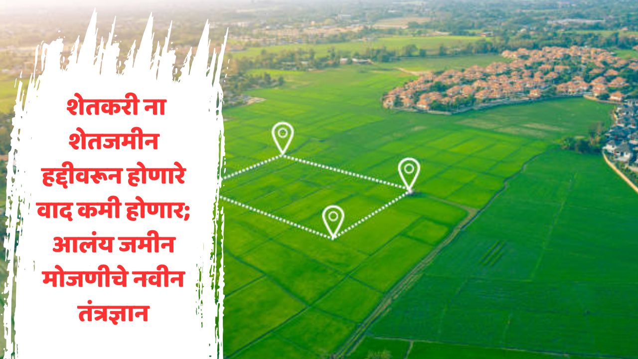
- हद्दीवरील वाद कमी होणार:
यापूर्वी, शेतजमिनीचे मोजमाप करताना मनुष्यबळाचा मोठ्या प्रमाणावर वापर केला जायचा. यासाठी खूप वेळ आणि खर्च लागायचा. मात्र, आता ड्रोन सर्वेक्षणाच्या माध्यमातून जमिनीचा अचूक मॅप तयार करता येतो. ड्रोनच्या मदतीने गावातील प्रत्येक जमिनीचा डिजिटल नकाशा तयार केला जातो. - जमिनीचा स्पष्ट हिशोब:
ड्रोन तंत्रज्ञानाचा वापर करून, प्रत्येक शेतकऱ्याची एकरवार जमीन मोजली जाते. त्यामुळे एखाद्या शेतकऱ्याकडे नेमकी किती जमीन आहे, हे स्पष्टपणे समजते. यामुळे कोणतीही गोंधळ किंवा हद्दीवरून होणारे वाद कमी करण्यास मदत होते. - वेळ आणि श्रमांची बचत:
ड्रोनच्या मदतीने मोठ्या जमिनीचे मोजमाप काही तासांमध्ये पूर्ण करता येते. यामुळे आधीच्या पारंपरिक पद्धतींच्या तुलनेत वेळ आणि श्रमांची मोठ्या प्रमाणावर बचत होते.
हे पण वाचा : SBI Scheme 2025: नवीन वर्षात SBI ची नवीन योजना – प्रत्येक घर होणार करोडपती !
अचूकता आणि गतिमानता
रोव्हर तंत्रज्ञानामुळे शेतजमीन मोजणीत अचूकता आणण्यामध्ये मोठा बदल झाला आहे.
- अचूक मोजणी:
रोव्हर उपकरणांचा वापर करून जमिनीचे मोजमाप करताना अचूकता मिळते. एखाद्या जमिनीची चौकट, हद्द किंवा आकार अगदी बिनचूकरीत्या निश्चित करता येतो. - प्रकरणे जलद मार्गी:
रोव्हरमुळे मोजणी प्रक्रियेत गतिमानता आली आहे. यामुळे शेतकऱ्यांची प्रलंबित प्रकरणे लवकर सोडवण्यास मदत होते. - उच्चशिक्षित मनुष्यबळ:
भूमी अभिलेख विभागात बीई शिक्षण घेतलेल्या तज्ञ तरुणांना रोजगाराच्या संधी उपलब्ध झाल्या आहेत. हे तंत्रज्ञ रोव्हर यंत्रणा आणि संगणक प्रणाली सहज आत्मसात करतात, ज्यामुळे प्रशासनाला कामे जलद आणि अचूकरीत्या करण्यास मदत होते.
ऑनलाइन अर्ज प्रक्रियेमुळे पारदर्शकता
पूर्वी, शेतजमिनीच्या मोजणीसाठी अर्ज प्रक्रिया ऑफलाइन पद्धतीने केली जायची. यामध्ये दलाल, खाबुगिरी, आणि वशिल्याचा वापर होण्याची शक्यता अधिक असे. मात्र, आता ऑनलाइन अर्ज प्रक्रियेमुळे मोजणीची कामे अधिक सुव्यवस्थित आणि पारदर्शक झाली आहेत.
- नियमबद्ध क्रम:
ऑनलाइन अर्जामुळे आता नियमाप्रमाणे प्रत्येक अर्जाचा नंबर निश्चित होतो. कोणत्याही वशिल्याचा किंवा ओळख-पाळख करण्याचा उपयोग शक्य होत नाही. - वेळेची बचत:
अर्ज ऑनलाइन दाखल केल्यामुळे शेतकऱ्यांना कार्यालयाच्या वारंवार फेर्या मारण्याची गरज उरली नाही. त्यांना त्यांच्या नंबरनुसार वेळेत सेवा मिळते.
गावांसाठी डिजिटल पत्रिका
केंद्र सरकारने लागू केलेल्या स्वामित्व योजनेंतर्गत शहरी भागांसोबतच ग्रामीण भागातील शेतजमिनींचेही सर्वेक्षण केले जात आहे.
- डिजिटल नकाशा आणि पत्रिका:
गावागावांतील जमिनीचे डिजिटल नकाशे तयार करण्यात येत आहेत. यामुळे शेतकऱ्यांची जमीनपत्रिका अत्यंत अचूकपणे तयार होते. - वाद टाळण्यास मदत:
स्वामित्व योजनेअंतर्गत प्रत्येक मालकाला त्यांच्या जमिनीची डिजिटल पत्रिका दिली जाते, ज्यामुळे हक्कांबाबत होणारे वाद टाळण्यास मदत होते.
तंत्रज्ञानामुळे भविष्याचे बदल
शेतजमीन मोजणीत हायटेक तंत्रज्ञानाच्या वापरामुळे संपूर्ण प्रक्रिया पारदर्शक, जलद आणि अचूक झाली आहे.
- ड्रोन आणि रोव्हरचा वापर: या आधुनिक उपकरणांमुळे मोठ्या प्रमाणावर वेळेची बचत होते, आणि शेतकऱ्यांचा विश्वास जिंकता येतो.
- उच्चशिक्षित तज्ञ: मोजणीच्या कामांमध्ये तरुण तंत्रज्ञांचा सहभाग वाढल्यामुळे प्रशासनाला नवी ऊर्जा मिळाली आहे.
- वादांवर नियंत्रण: अचूक मोजणी आणि डिजिटल नकाश्यांमुळे जमिनीच्या हक्कांबाबत होणारे वाद कमी होण्याची शक्यता आहे.
ड्रोन आणि रोव्हरसारख्या अत्याधुनिक तंत्रज्ञानामुळे शेतजमिनीच्या मोजणी क्षेत्रात मोठ्या प्रमाणावर क्रांती होत आहे. यामुळे मोजणीची प्रक्रिया अधिक विश्वासार्ह झाली असून शेतकऱ्यांचा प्रशासनावरचा विश्वास वाढत आहे. डिजिटल नकाशे, ऑनलाइन अर्ज प्रक्रिया आणि उच्चशिक्षित तंत्रज्ञांच्या सहभागामुळे ही संपूर्ण प्रक्रिया शेतकऱ्यांसाठी एक नवसंजीवनी ठरत आहे.
Modern Land Measurement Technologies: A Comparative Table
| Technology | Key Features | Benefits | Impact on Farmers |
|---|---|---|---|
| Drone Technology | – Aerial surveys and mapping | – Accurate digital maps of land | – Reduces boundary disputes |
| – Captures large areas quickly | – Saves time and effort | – Provides clear ownership records | |
| – High-resolution imaging | – Precision mapping of agricultural plots | – Minimizes reliance on manual measurements | |
| Rover Technology | – GPS-enabled ground measurements | – Highly precise boundary determination | – Faster resolution of land disputes |
| – Advanced sensors for data accuracy | – Reduced errors in land measurements | – Builds trust in government processes | |
| – Portable and efficient | – Improves administrative efficiency | – Quicker case settlements | |
| Online Applications | – Digital submission of requests | – Streamlined and transparent application process | – Farmers save time with reduced office visits |
| – Systematic numbering of applications | – Eliminates favoritism and corruption | – Ensures fair and equal service delivery | |
| – User-friendly interface | – Saves costs related to middlemen | – Easier access to services | |
| Digital Records | – Creation of digital land maps | – Easy storage and retrieval of land records | – Prevents ownership disputes |
| – Integration with Swamitva Scheme | – Accurate documentation of property ownership | – Farmers receive verifiable digital certificates |
Jamin Mojani: Revolutionary Advancements in Land Measurement Technology
The field of agricultural land measurement is experiencing rapid technological development, making the process more precise and efficient. Modern techniques are reducing farmers’ stress and saving time and money. Particularly with advanced tools like 57 state-of-the-art rover systems and drone technology, the measurement process has become simple and reliable. Let’s dive into how this new technology works and explore its benefits in detail.
Drone Technology: Mapping Land from the Sky
Drone technology has brought a revolutionary change to the measurement of agricultural lands.
Reducing Boundary Disputes:
In the past, land measurement relied heavily on manpower, requiring significant time and resources. However, with drone surveys, an accurate map of the land can now be created. Using drones, digital maps of each plot in a village can be prepared with precision.
Clear Land Records:
With the help of drones, the exact area of each farmer’s land is measured. This ensures transparency in determining the exact amount of land owned by a farmer, helping to reduce disputes over boundaries.
Saving Time and Effort:
Large tracts of land can be measured within hours using drones. Compared to traditional methods, this saves both time and labor on a significant scale.
Accuracy and Efficiency with Rover Technology
Rover technology has brought a new level of precision to land measurement.
Precise Measurements:
Rover devices ensure accurate measurement of land. The boundaries, shape, and size of any land parcel can be determined with remarkable precision.
Faster Resolutions:
The rover system has introduced speed to the measurement process, helping resolve pending cases swiftly.
Opportunities for Skilled Workforce:
The land records department now offers employment opportunities to highly skilled young professionals with BE degrees. These technicians can easily adapt to rover systems and computer technology, aiding the administration in completing tasks quickly and accurately.
Transparency Through Online Application Process
Earlier, applications for land measurement were processed offline, leaving room for intermediaries, favoritism, and malpractice. Now, the online application process has made land measurement work more organized and transparent.
Systematic Process:
With online applications, every request is assigned a specific number, eliminating favoritism or the need for personal connections.
Time-Saving:
Farmers no longer need to make repeated trips to offices to submit applications. They receive services promptly according to their application number.
Digital Records for Villages
Under the “Swamitva” (Ownership) Scheme initiated by the central government, surveys are being conducted in rural areas alongside urban ones.
Digital Maps and Records:
Digital maps of lands in villages are being prepared, resulting in highly accurate land records for farmers.
Avoiding Disputes:
Under the Swamitva scheme, each landowner is provided with a digital record of their land, which helps prevent disputes regarding ownership.
Technology’s Transformative Impact on the Future
The use of high-tech tools in land measurement has made the entire process transparent, fast, and precise.
- Use of Drones and Rovers: These modern devices save considerable time and foster trust among farmers.
- Skilled Professionals: Increased participation of young, trained technicians in measurement tasks is rejuvenating the administration.
- Control Over Disputes: Accurate measurement and digital mapping are expected to significantly reduce conflicts over land ownership.
With state-of-the-art tools like drones and rovers, agricultural land measurement is undergoing a massive transformation. The process is now more reliable, and farmers’ trust in administrative systems has grown. Digital maps, online applications, and the involvement of skilled professionals have made this entire process a revitalizing force for the agricultural sector.